Question 1
International Relations | Places in news | Easy | Indian Express
SOURCE
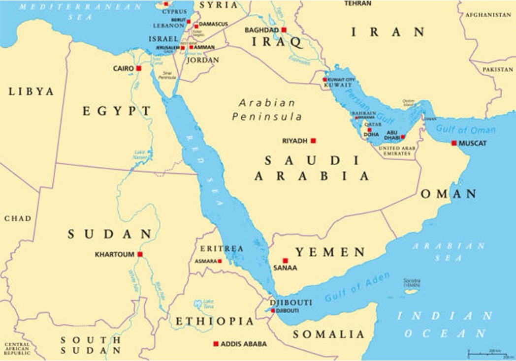
Which of the following does not fall in or around the Red Sea?
A. Sinai Peninsula
B. Persian Gulf
C. Gulf of Suez
D. Gulf of Aqaba
Solution & Detailed Explanation
Answer: (B) Persian Gulf
Detailed Explanation
Question 2
Economy | Markets | Easy | Indian Express
SOURCE
Which of the following is not a market derivative?
A. Options
B. Forwards
C. Bonds
D. Futures
Solution & Detailed Explanation
Answer: (C) Bonds
Detailed Explanation
- Derivatives are financial instruments that get their value from assets like stocks, bonds, commodities, or currencies.
- They help investors manage risk, invest wisely, and earn profits from price changes.
- Derivatives are traded on exchanges or directly between buyers and sellers (OTC markets).
- In India, they are popular among investors, traders, and institutions.
Question 3
Environment | Climate Change | Medium | Indian Express
SOURCE
Consider the following under the Carbon Credit Trading Scheme:
1. CCTS replaced the Perform, Achieve and Trade(PAT) Scheme.
2. Every single Carbon Credit Certificate denotes one tonne CO2 equivalent (tCO2e) reduction.
Which of the following statement is or are correct?
A. 1 only
B. 2 only
C. Both 1 and 2
D. None of the above
Solution & Detailed Explanation
Answer: (C) Both 1 and 2
Detailed Explanation
- CCTS: The CCTS is a market-based mechanism introduced to regulate and trade carbon credits under the ICM.
- The CCTS aims to decarbonize the Indian economy by pricing greenhouse gas (GHG) emissions and facilitating carbon trading.
- Transition from PAT to CCTS: The PAT scheme focused on energy efficiency improvements in energy-intensive industries through Energy Saving Certificates (ESCerts).
- CCTS replaces PAT, shifting the focus from energy intensity to reducing GHG emission intensity, monitoring emissions per tonne of GHG equivalent.
- It issues Carbon Credit Certificates (CCC), each representing a one-tonne CO2 equivalent (tCO2e) reduction.
Question 4
International Relations | International Treaties | Medium | The Hindu
SOURCE
Consider the following:
1. The Plant Treaty is being implemented through its association with the FAO.
2. International Treaty on Plant Genetic Resources for Food and Agriculture being an international treaty is not legally binding agreement.
Which of the following statement is or are correct?
A. 1 only
B. 2 only
C. Both 1 and 2
D. None of the above
Solution & Detailed Explanation
Answer: (C) Both 1 and 2
Detailed Explanation
India signed the International Treaty on Plant Genetic Resources for Food and Agriculture (ITPGRFA), also known as the Plant Treaty, in 2001. The treaty was adopted during the 31st session of the Food and Agriculture Organization (FAO) in Rome in November 2001 and came into effect on June 29, 2004.
The ITPGRFA is a legally binding agreement that focuses on the conservation and sustainable use of plant genetic resources for food and agriculture. It also aims to ensure the fair and equitable sharing of benefits arising from the utilization of these resources. India is one of the 149 contracting parties to the treaty.

Question 5
Miscellaneous | Places in News | Easy | The Hindu
SOURCE
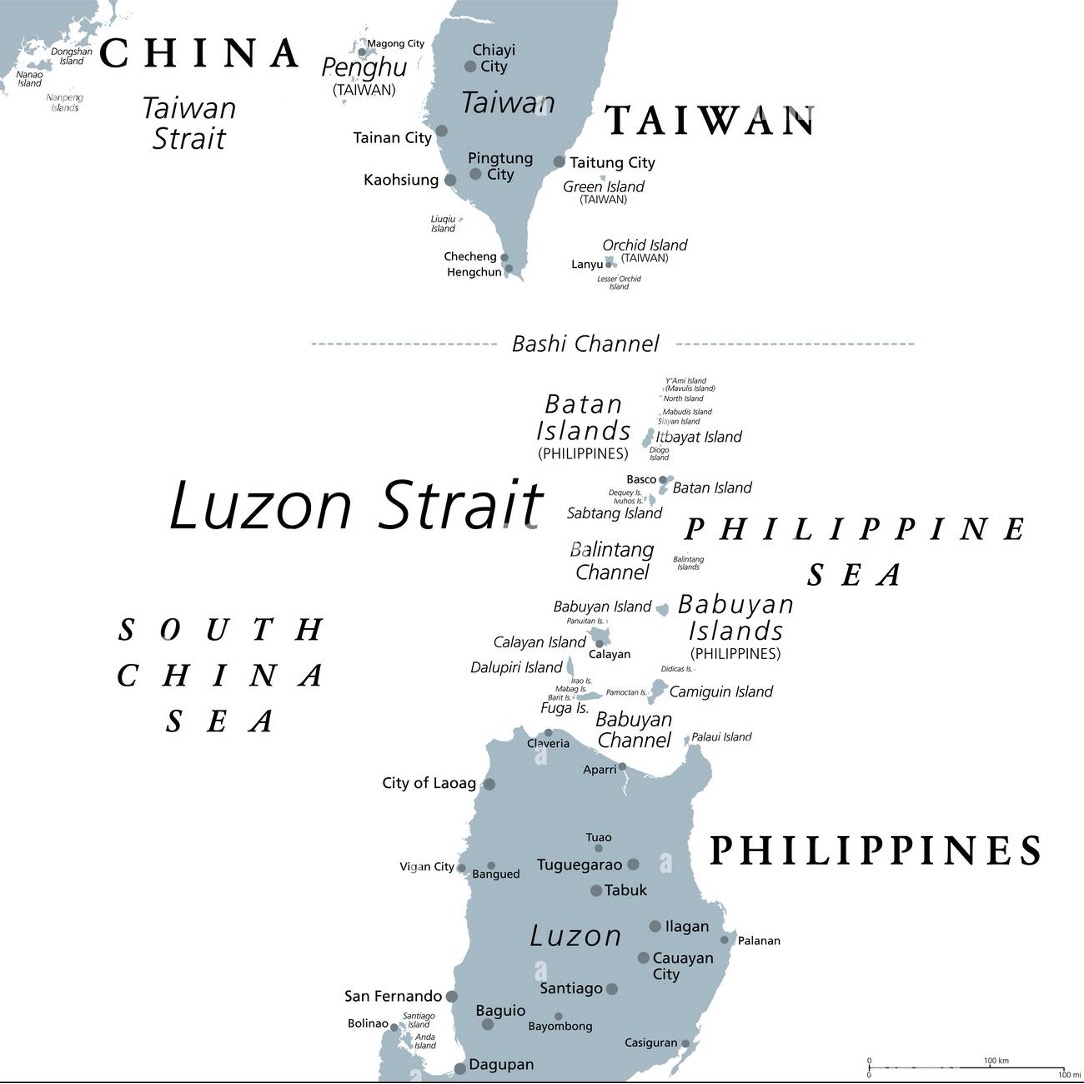
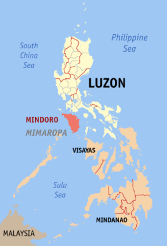
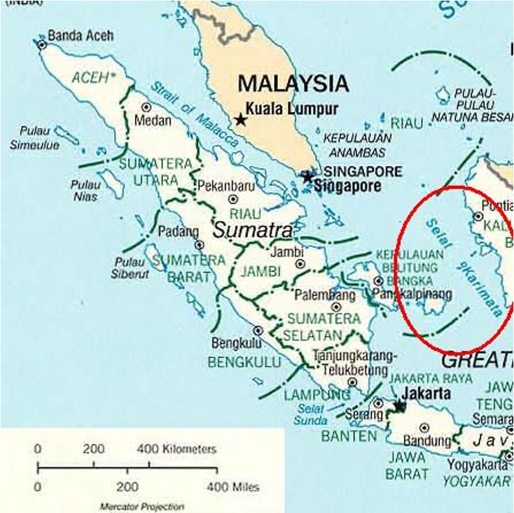
The strait which connects the Philippine Sea to the South China Sea in the western Pacific Ocean is?
A. Luzon Strait
B. Taiwan Strait
C. Karimata Strait
D. Mindoro Strait
Solution & Detailed Explanation
Answer: (A) Luzon Strait
Detailed Explanation
Question 6
Geography | Development | Medium | The Hindu
SOURCE
Consider the following:
1. Great Nicobar Island Infrastructure Project is a ₹72,000 crore mega-infrastructure project.
2. It was proposed by the Union Shipping Ministry.
Which of the following statement is or are correct?
A. 1 only
B. 2 only
C. Both 1 and 2
D. None of the above
Solution & Detailed Explanation
Answer: (C) Both 1 and 2
Detailed Explanation
Key Takeaways:
- The Great Nicobar Island (GNI) infrastructure project was conceived by NITI Aayog and launched in 2021. The key plans include the construction of the “International Container Transshipment Terminal (ICTT), a greenfield international airport with a peak hour capacity to handle 4,000 passengers, a township, and a gas and solar-based power plant spread across 16,610 hectares.”
- The project is being implemented by the Andaman and Nicobar Islands Integrated Development Corporation (ANIIDCO). It aligns with India’s Maritime Vision 2030 and is one of the key projects under the Amrit Kaal Vision 2047. It also gives an opportunity to leverage the strategic location of the island, which is roughly equidistant from Colombo in Sri Lanka to the southwest and Port Klang (Malaysia) and Singapore to the southeast.
- The infrastructure development on the island has been slow-paced. The distance from the mainland, complex procedures for obtaining environmental clearances, and significant coordination challenges among ministries, departments, and agencies have acted as hurdles in the development. Through this development project, the government aims to address these problems.
Geographic Location
- The Andaman and Nicobar Islands are a cluster of 836 islands, split into two groups — the Andaman Islands to the north and the Nicobar Islands to the south — by the 150-km wide Ten Degree Channel.
- Great Nicobar is the southernmost and largest of the Nicobar Islands, a sparsely inhabited 910-sq-km patch of mainly tropical rainforest in the southeastern Bay of Bengal. Indira Point on the island, India’s southernmost point, is only 90 nautical miles (less than 170 km) from Sabang at the northern tip of Sumatra, the largest island of the Indonesian archipelago.
- Great Nicobar has two national parks, a biosphere reserve, small populations of the Shompen and Nicobarese tribal peoples, and a few thousand non-tribal settlers.
Strategic Location
- It is close to the Malacca Strait, the main waterway that connects the Indian Ocean to the Pacific, and the ICTT is expected to “allow Great Nicobar to participate in the regional and global maritime economy by becoming a major player in cargo transshipment’’. A proposed “greenfield city” will tap into both the maritime and tourism potential of the island.
- Sabang in Indonesia is 90 nautical miles southeast of Indira Point (on Great Nicobar island), and Coco Island (Myanmar) is barely 18 nautical miles from the northernmost tip of the Andamans. Should Thailand build the Kra Canal connecting the Gulf of Thailand with the Andaman Sea, its mouth would be about 350 nautical miles east of Port Blair.
- In the foreseeable future, a serious challenge could emanate from a build-up of Chinese maritime forces at the eastern choke points of the Indo-Pacific. The A&N Islands should be the first line of offence against any attempt from the East to undermine India’s maritime security.
- Andaman and Nicobar Islands share four of India’s international maritime zone delimitations with Myanmar, Thailand, Indonesia, and Bangladesh. They also give India substantial ocean space under the United Nations Conference on the Laws of the Sea (UNCLOS) in terms of exclusive economic zone and continental shelf.


